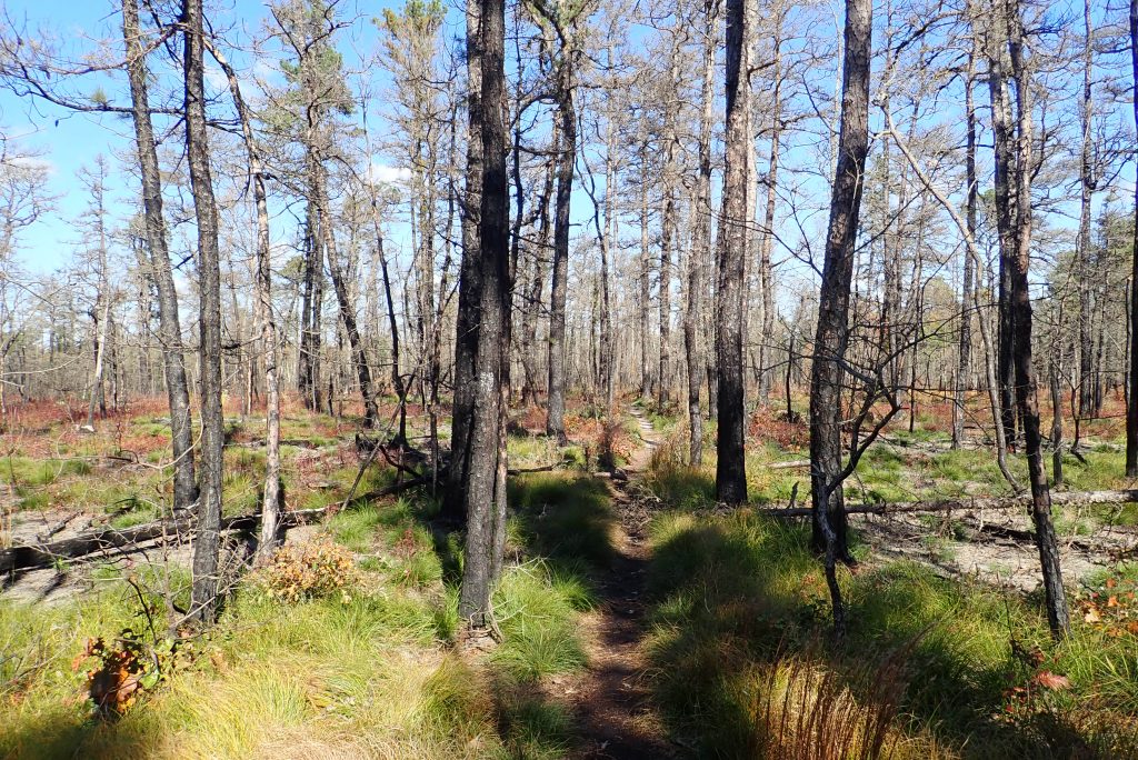
Batona Trail through the Pine Barrens in Wharton State Forest
I took a trip to New Jersey to check out the Pine Barrens in Wharton State park. This was a quick overnight trip that should be suitable for novice backpackers but is also a fun night out in the woods for anyone who just wants to get away.
The Dirt:
Length: 15 miles (approximately 7.5 miles per day)
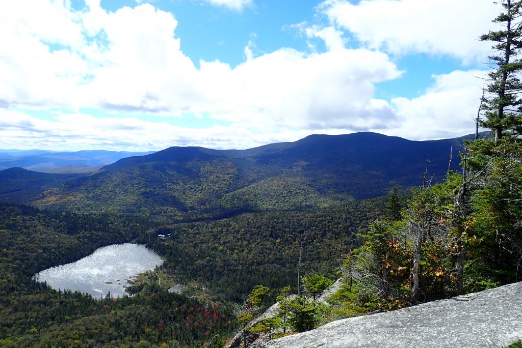
Many people have a goal to do all of the NH 4000 footers at some point in their lives. I never really shared that desire until this year. Unfortunately, you need to document the dates you hiked to each summit so many of the peaks I have hiked in the past will need to be completed again so I can set a date for each peak. This trip will allow me to bag three more peaks: South Kinsman, North Kinsman and Cannon Mountain.
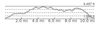
The hike, at only 11-12 miles could be done as a day trip but I chose to do this as an overnight backpacking weekend, staying at Kinsman Pond. With a total elevation gain of 4500 feet, it still can be a bit of a challenge for some so don’t let the short length fool you into thinking this is a beginner hike. If you do this as an overnight, the mileage is roughly 6 miles for each day.
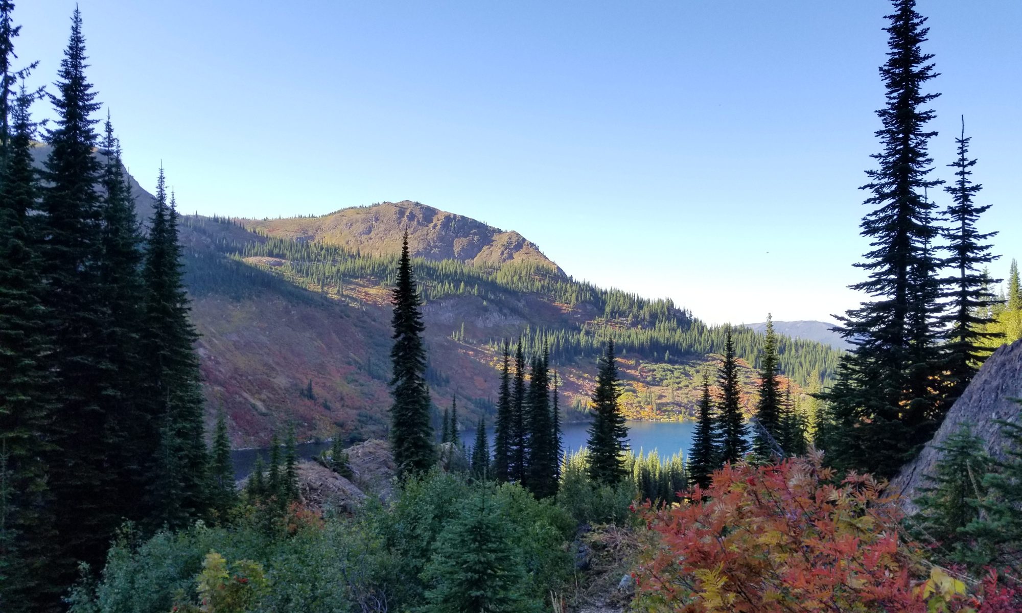
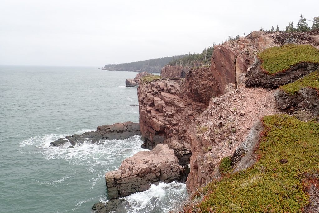
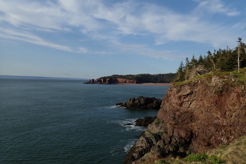
If I was smart, I would have done this post when everything was fresh in my mind. Instead, I was lazy and here we are over a month later and I am just sitting down to start writing up a trip report. On Memorial Day weekend, May 25-27, 2018, I decided to backpack the loop around Cape Chignecto, Nova Scotia. This is a brief summary of the trip:
Day 1:
I woke up in the backseat of my car to the sound of rain tapping on the windows. Looking out, I was about to see my first views of the Bay of Fundy which would become the backdrop of my next few days. When checking the weather the night before, it appeared like there would be some clearing during the day and then the rain would come back at night so I wasn’t in any rush to get wet right away. If I planned this right, I should be able to get to camp in the window of no rain.
I made my way across the parking lot to check in at the ranger station. The staff was helpful and they gave me a photocopy of a map as well as the tide information. Just so you know, you will need to check in with them before you head out on your trip. If you are planning a trip to Cape Chignecto, I also wrote a post to help with that as well.
The first decision you have to make is whether to take the trail or the beach route. If the tide is on your side, the walk up the beach will save you about .7 miles and the climb over a hill. I didn’t go over the hill on the way out or the way back so I can’t tell you if there are any views up there. After heading up the beach you will see a yellow sign and some spray paint on the rocks where you will turn right and head up a flight of stairs. At this point, you are officially on the trail.
Cape Chignecto Provincial Park sits on the Bay of Fundy in Nova Scotia, Canada. On it resides a 33 mile (53km) backpacking loop that I had my eye on for years. Looking at the pictures had me salivating at the beauty but the thought of such a long drive for a 3 day backpacking trip seemed excessive. As a point of reference, it is around a 13-15 hour drive from my house depending on traffic and pit stops. The other thing that seemed to hold me back was the lack of information about some aspects of the trip. In this post I will try to fill you in on a few things that may help you plan.
Let’s start at the beginning and go from there. First, there are three types of camping spots on the Cape. There are huts, backcountry sites and kayak sites. All three require a permit and permits are not free. As of this writing, the camp sites are $26.70 CAD while the huts are $59.40 CAD. I actually didn’t check if there are different prices for holidays so you will need to check that out. You can reserve your sites here.
Parking at the park is in a nice large lot by the welcome center and there is no fee for parking. That said, you are only allowed to park there overnight if you have a permit for that evening and have checked in. I hope you noticed the end of that last sentence. When you get to the park, you need to check in before you head out so don’t arrive before they are open and just start hiking. Also, you should let them when you are done at the welcome center as well. I would like to mention that the people working in the welcome center were AWESOME! They gave me a photocopy of a map with mileage on it, the tide chart for the weekend, and also information about the camp sites. Also, they were just really nice. Kudos to them!
Let’s talk about mileage. When I was planning my hike I wasn’t sure about the exact mileage of each segment because it seemed hard to find online. When I got there, it wasn’t much better since they gave me a map and that map didn’t match the signs in the park. Let’s just go with the map since it was a photocopy and would be easier to change the actual signs in the park so it is probably more accurate. The photocopy was not very clear to begin with and then spent a weekend in my pocket so I am not going to bother scanning it in here. Instead, I will just list in the data points on the map. So you can follow along, there is a map on the park brochure. You will notice the individual mileages don’t add up to 33 miles (53km) even on the map but I guarantee you will walk more than 33 after walking to every lookout and exploring every cove.