I took a trip to New Jersey to check out the Pine Barrens in Wharton State park. This was a quick overnight trip that should be suitable for novice backpackers but is also a fun night out in the woods for anyone who just wants to get away.
The Dirt:
- Length: 15 miles (approximately 7.5 miles per day)
- Elevation gain: 213 feet (Flat as a pancake)
- Type: Loop
- Permits: Needed – I paid $10 total.
The Trails:
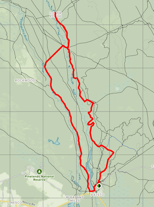
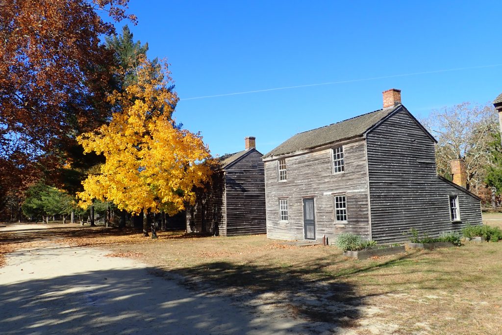
You will park at Historic Batsto Village and pick up your permit at the visitor center. Maps are also available from there.
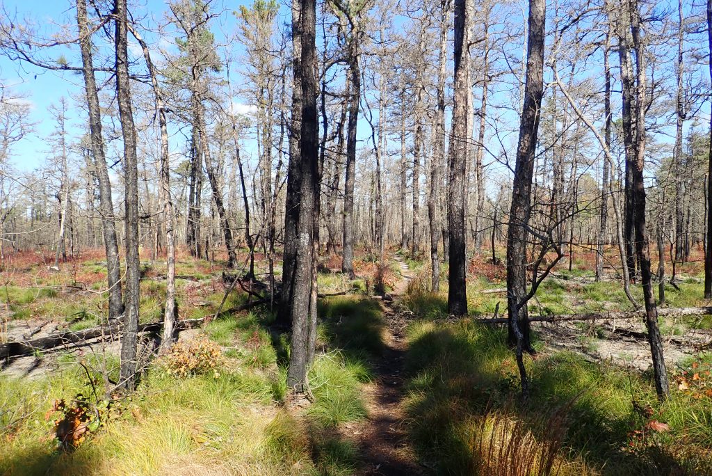
- From the back of the parking lot, you will make your way to the Batona Trail. This is marked by pink blazes. I believe some of the connector trails were blazed in white until I found the pink blaze but that might just be where I cut into the woods. It wasn’t hard to find with the map provided at the information board outside of the visitor center.
- When you reach the Batona Trail, you will be heading North. It should be a left turn.
- Continue on the Batona through many intersections for about 6 miles to signs for Quaker Bridge. Remember this spot because you will head over the bridge on your return trip.
- Continue on the Batona until you see signs for Lower Forge on your left. Actually, the Batona goes to the right so Lower Forge seems more straight than a left. Proceed towards Lower forge.
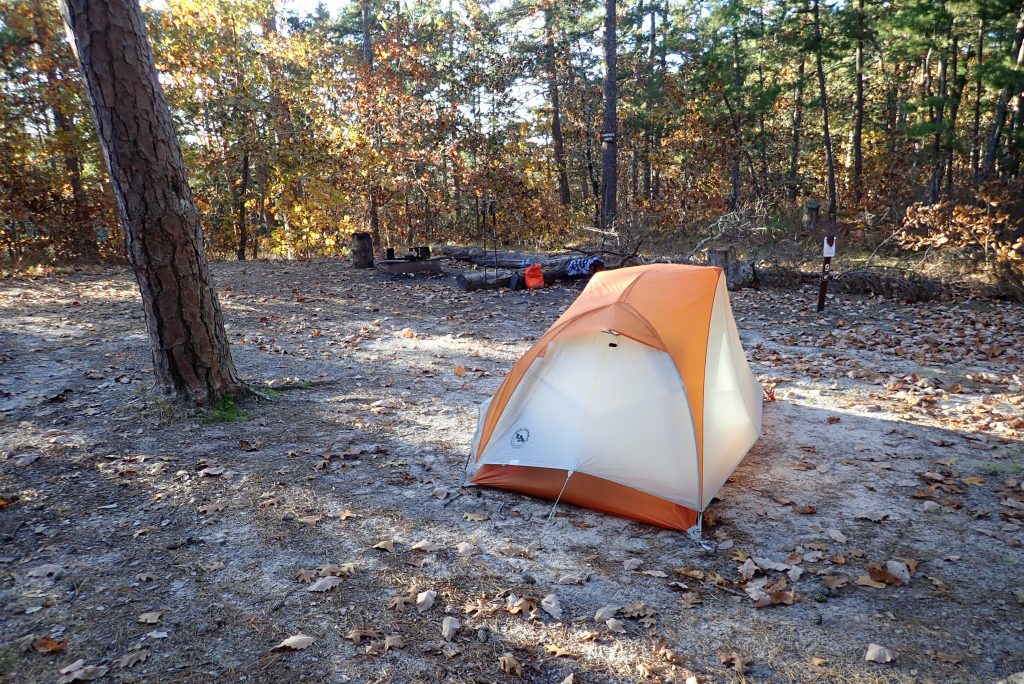
- In about .5 miles you should come upon the camping area. There are little posts that designate the camping locations and you can slide your permit under post number.
- In the morning, retrace your steps to Quaker Bridge and then head to your right over the bridge.
- You will pass Batso River Road on your left but continue straight.
- Soon you will come up to the only confusing portion of the trail. The trail you will be going on is the “Wilderness Camps Connector Trail” which is blazed in green. You will see an entry into the woods up on left (almost straight but slightly left) and is blazed in purple and green for about 200 feet or so. The connector takes a hard left into the woods without much fanfare so I walked right by it. If you are walking on the purple trail for long, you probably walked by it too. Take a left on the green trail.
- You will stay on the green trail for about 0.8 miles until you intersect with the Yellow Trail (Mullica River Trail). Take a left at that intersection.
- Continue on the Yellow Trail for about 5 miles. You will pass right through a campground on this trail.
- You will pass a boat launch on your left and shortly after the trail makes it’s way through a fence and into the Batsto Historic Village. If you miss this, don’t worry. Following the road for anther 0.2 miles will put you on the Batsto Village Road where you can enter the village as well.
- Take a left into the village and walk by some scenic old buildings on the way back to the parking area.
Trail Notes and Other Data:
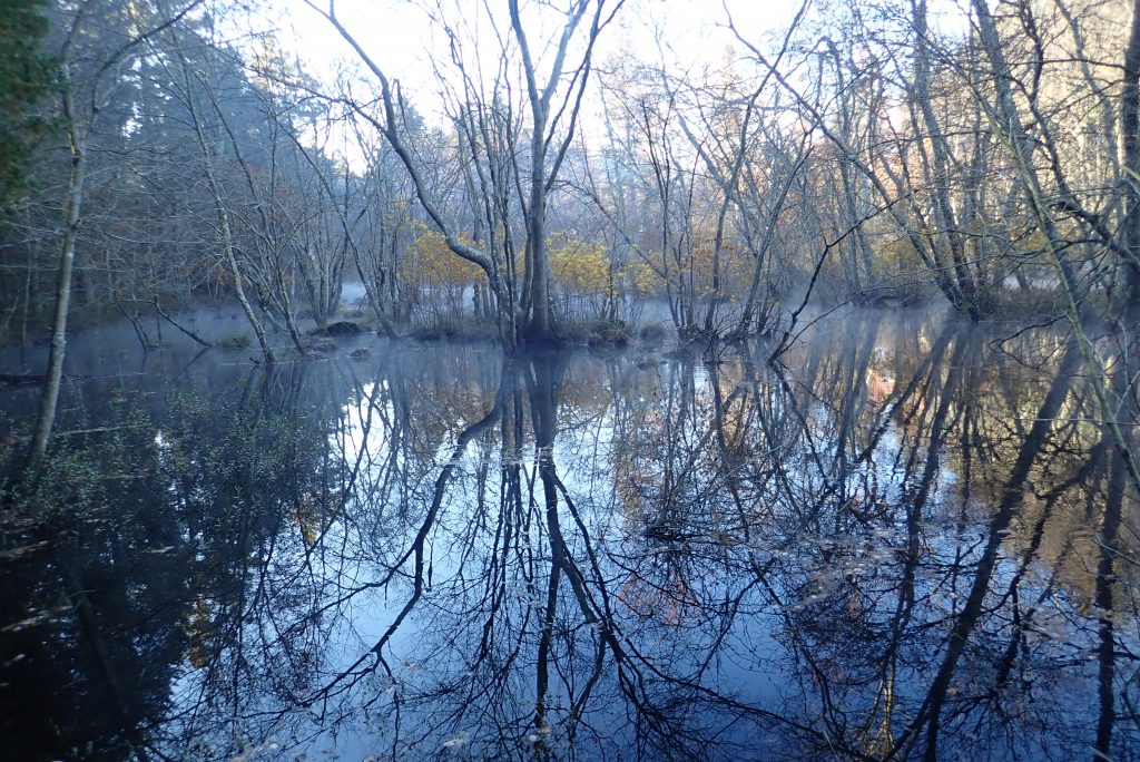
The trail is FLAT. Some people may find this loop boring but it is the type of place where you can just get in a rhythm and go. The footing is soft and sometimes sandy but it also allows you to move at a good pace. Fires were allowed the night I was at Lower Forge so getting to camp a little early was nice and I had a great fire to watch for hours.
Reservations are required for Lower Forge and all camping areas in Wharton State Forest. I don’t reside in NJ so it cost me $10 but that is a small price to pay for a wonderful evening in the woods. You can pick up your permit and do all of the check in things in the visitor center in Batsto Village.
Water:
Water is taken from the slow moving rivers (Batsto and Mullica). They look very dark as they are stained from iron as they rise to the surface in the Pine Barrens. Apparently there is a huge aquifer under this area so the water is very tasty. That said, slow moving water means floaters in your water filter so I first filtered it through a bandana before putting it through the filter to avoid clogging it really fast.
Final Thoughts:
I enjoyed the trip but if you are looking for big payoffs (sick views), this might not be the trip for you. One thing I noted was the lack of animals in this area. I am not sure why but it almost seemed spooky. I saw only one squirrel in 15 miles of hiking. That is so unusual in the northeast that I thought I would mention it. Also, there weren’t many birds chirping either. Just dead quiet.
Thinking about doing modified mullica river trail and batona trail. Do I need a permit to go backpacking and can I make my own site? The information online is vague and I haven’t spoken to the rangers yet.
Permits are needed to camp and you must camp at approved camping areas. If I remember correctly, your permit will say which site you will be camping at.
Thank you for posting this. We are about to do the same trip this weekend to test out our backpacking chops